Monday 31 August 2009

Lake District Runs

This weekend I went did some training in the Lake District. We drove up to Keswick on Friday night and stayed in a hotel, which will be a world apart from the actual event where we will be staying in a tiny lightweight two-man tent. We had breakfast early on Saturday morning and then drove out to the start location, about 15 miles from Keswick, at Fell Side. Fell Side is about 4 or 5 buildings on a very narrow country road. The weather was forecast for rain all weekend, so we dressed in waterproofs straight away. Below is the map of the area. The red line is the route we actually did, and includes the 4.5 mile run/walk back to the car after reaching the "Overnight camp" location at the end of the days effort. The blue line was the other option that we decided not to do.


If the map looks a little unfamiliar it is because it is a Harvey 1:40k map, and not the usual Ordnance Survey 50k, or 25k ones I usually post on here. The blue route is a much shorter distance (10 miles), but was a "hilly" and "high" route, whereas the one we chose was overall much flatter, keeping to the foothills, but was a lot more ambitious at 18 miles long. Last time we practiced a hilly route, we only averaged 1.7mph, so we calculated we could cover 10 miles at that pace.

We had no idea how much we could cover on a more flat route, but hoped for as much as 3mph overall. So, we decided to try the flat route as an experiment, even more so because we would collect controls (and thus more points)than we would from the controls on the hilly route.


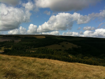
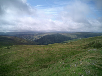
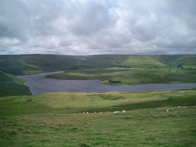
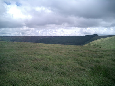
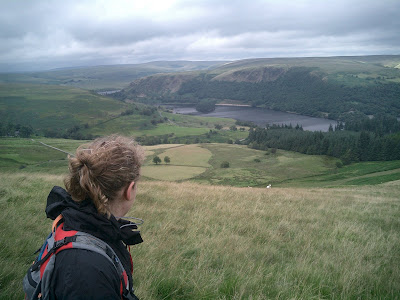
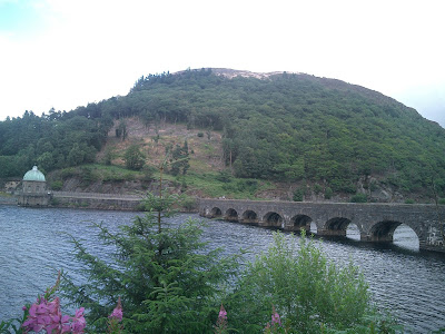
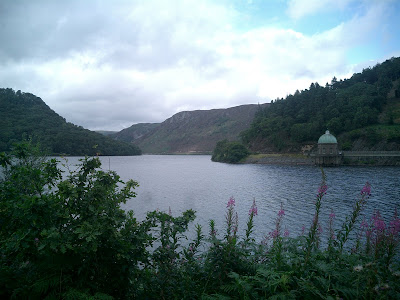
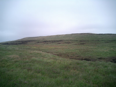
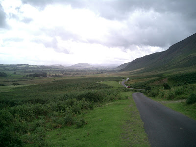
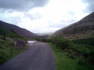
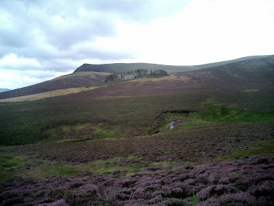
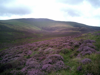
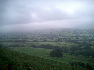
We set off and as you can see, did an initial climb, following a beck (a stream) up the side of High Pike. When we thought we had got to the location, navigating only by map and compass, I confirmed it on the PDA/GPS I carried (I won't get to use any GPS in the real event of course). We then continued uphill to an old abandoned mine and the second control. I then took over navigation from my girlfriend, and we then descended and picked up a wide trail and then decided to run for around 30 mins (as you can see from the speed profile). We picked up the next control by the road which contours the fells, and followed beside the road (pictured below) to a small village called Mosedale.


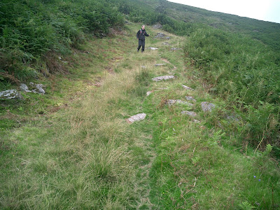
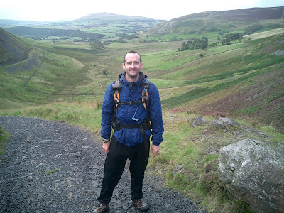
Here we took a 10 minute walking break before running on again to pick up the next control (numbered 22). Here I took this from that position looking at the way ahead.


Here, the last of the road before it ends.


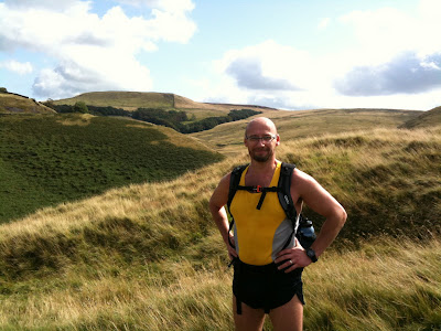
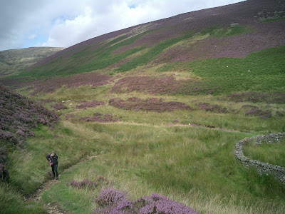
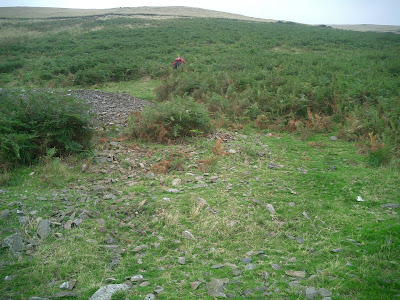
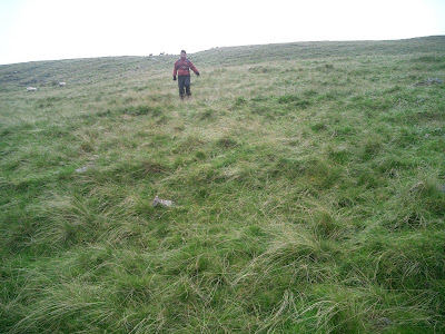
My girlfriend (gf) took over navigation again (we navigated two controls each, then swapped). About 1km after control 22, the gradient increased sufficiently for us to slow to a fast walk and continue onto the next control, 23, which was in a Sheepfold about 60m up a hill. It was a short sharp and fairly steep climb. That's my gf climbing up to me at the sheepfold.


We continued on at a fast walk on the footpath at this stage to find control 18 at another sheepfold, where I took this looking back.


This photo looking forward to Lonscale Fell in the far distance.


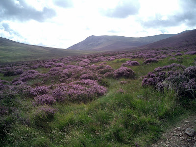
This one looking up to Great Calva, which we didn't climb today.


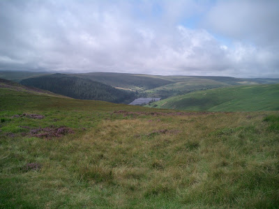
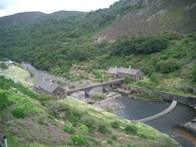
Just before the next control, 18, we passed near to Skiddaw House, a Youth Hostel, about 2.5 miles from the nearest road, nestled on the very low foothills of Skiddaw itself.


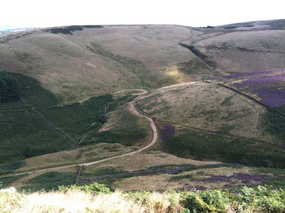
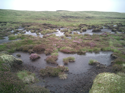
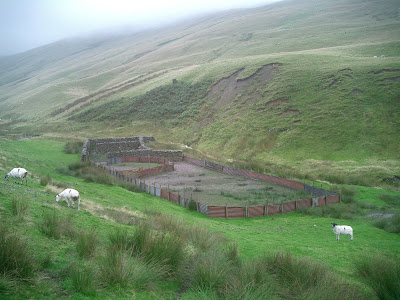
Control 18 was a high value control and proved to be more challenging to navigate to across thick heather, very boggy ground, and crossing some wider streams, as well as about 100m in height from the previous control. This phot was looking up towards the control, which was another sheepfold about a third of the way up the hill.


The weather took a turn for the worse at this stage and we had a short heavy downpour, just as we got back onto the Cumbrian Way footpath again.


My girlfriend displaying her improving descending skills.


We picked up the straightforward control 16, which was right on the path just near to my gf took this photo. We would be headed to the far right next.


We went down into the valley and across a stream where I tore my brand new pair of waterproof trousers. They trousers are very lightweight, and clearly have no rip-stop material. I caught them as my leg brushed on a fence and they tore a 6 inch rip by the knee. I wasn't very happy at the durability of the trousers. 5 minutes later my girlfriend stumbled and caught her knee on a rock putting 2 small holes in her trousers too.


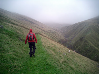
We picked up control 21 by the delightfully named hill "Great Cockup" and then contoured around "Meal Fell", which my gf found tough on her ankles. I descended down to the CP which was by the stream between the fells and took this photo of her coming down.


She had to take it a little easier as she had inverted her ankle so we couldn't run quite so much heading for the finish. We could have run a little more at the start I think. Anyway, as a result we got to the finish area in 6 hours and 4 minutes, so we would have had a few points deducted for being 4 mins late, but nothing serious. We had covered about 18 miles and average 2.8mph, with 2700ft of ascent. The speed was slightly slower than we thought, but overall we were very happy with and that information will prove valuable for planning our route on the actual event itself.


We then had a 4.3 mile run/walk back to the car, so covered 22.3 miles and 3700ft overall that day. Not a bad days effort I thought.


Back at the hotel we had a nice meal, which was even better as I didn't know it was included in the price of the room. I had booked a bed and breakfast rate, but when I checked in they said dinner was included. Bonus! If you are staying in Keswick I can recommend the Keswick Country Hotel, which despite the name is a stones-throw from the town centre, but has great views over the fells.


In the evening we decided that rather than do a second day on the same map, we would drive down to the Howgills and run around there.


We sat in a coffee shop in Sedbergh, and ate an early lunch and fuelled my gf with coffee, which is pretty important if you expect and sense or activity out of her. We planned the route as we ate. The little flags on the map are the random points that we would try and find, again using only map and compass, but verifying the location with GPS when we thought we had got there. It was already raining when we started and so once more the waterproofs were on. The weather was terrible all day. It didn't stop raining at all, and the cloud was quite low, plus it got quite windy up high.


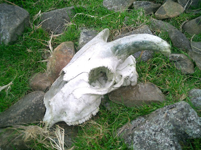
We headed up on a right of way until we crossed onto the fells and access land. We came across a favourite mountain talisman; the dead sheep skull.


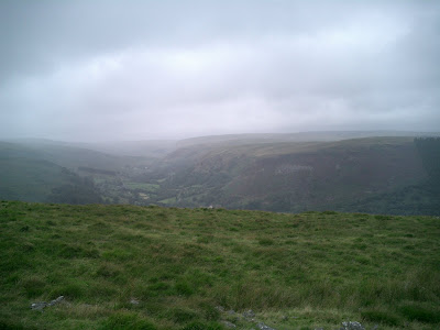
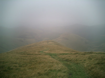
You can see the weather isn't very nice. This photo taken looking back, not forward, where it was worse!


We then had a very steep scramble up a bracken covered hill to reach an old footpath.


It was a lot steeper and harder going that it appears, our average pace pushed down to about 1mph.


We then contoured around the hill, about half way up it, and headed deeper in the fells, following a stream and found our first location; a sheepfold. Here my gf heads higher and into the cloud ahead.


After finding the first location by Sickers Fell, we then turned West and scrambled steeply uphill to join a marked footpath. By now we were totally enveloped in cloud. It was raining quite hard and was windy, and it was surprisingly cold. We navigated successfully (by pacing out 250m on a bearing) to a point marked "Rain Gauge" which now is just half a dozen pieces of smashed up wood on top of Arant Haw. We continued on in the worsening weather and were surprised to meet a group a people heading down. We thought we were the only people up there. We exchanged a joke about each thinking the other was bringing some hot tea to drink, before heading on. The wind really picked up and the rain came down harder, and I got flashbacks to the time in Tenerife where I thought I might not get back alive. Bad visibility, I am fine with, rain I am fine with, and cold weather I don't like, but I can tolerate. After that experience in Tenerife, when you put them all together now I get a little nervous.


I was starting to feel cold, but the rain and wind was sufficient that I didn't want to stop and take off my waterproof jacket and take out a fleece out of my rucksack, and then put it all back on again. I should learn to just stop as soon as I start to feel cold and layer up straight away. At the time, I just wanted to keep on moving and stay warm. Now on top of the mountain around 2100ft we were able to run again. I decided to miss out one proposed location and head down to lower ground, as much to ease my rising stress, as head into less harsh weather. So we headed down on a narrow path initially, before it opened out onto a wide slope. You can get an idea of the conditions from this photo I took of my gf descending at this point.


A couple of hundred metres lower down and we emerged from the thick cloud and regained some visibility. Stress levels dropped and returned to normal as the wind was lower too!


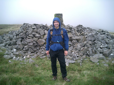
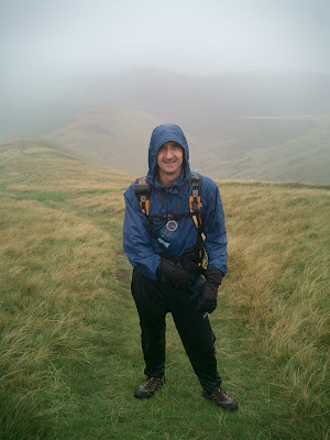
Here is me at that point


We next practiced navigation more by pacing, this time 900m, and then using reverse compass bearings to triangulate our position. We established where we thought a sheepfold was a headed steeply downhill to find it.


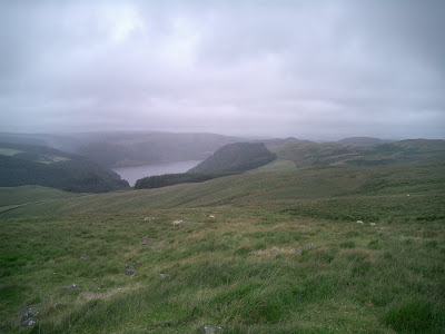
A picture looking back


Me pointing back to where we had come from, some 400m above. The summit was way above the cloud layer, that's just a false summit you can see at about 300M in height.


We then headed down into a valley, to another sheepfold, before another sharp climb up a gill and to a sheepfold that sat in the saddle between two hills.


We were impressed with our navigation, it had been spot on all day. We then dropped down and hand-railed around the dry stone wall that surrounds the access land around the fells, finding a couple more controls and then emerging by Lockbank Far. We covered 9.5 miles, 2730ft of ascent, in 4 hours and 15 mins; that's 2.2mph average. This is a slightly better average speed than expected.


Overall I was very pleased with how it went. We both learned a few lessons and tested out various bits of kit and clothes. I have found my new Marmot waterproof gloves may not be very waterproof after all, and that my North Face waterproof jacket needs re-proofing.


I am doing the 22 mile Hills and Dales event this weekend. I am looking forward to it. Have a god week!

Monday 24 August 2009

Peak District runs in the sun

Last week I did my usual gym sessions and yoga on a Tuesday, which I'm slowing improving at. My left knee still hurts when I sit cross legged, and maybe it always will. The muscle tone in my left leg (the one I had the knee operation on) has improved visibly. I've almost equalised it with the right leg. It's still a little down on climbing power, but it's getting there now. I didn't do a speed session last week since I intended to rack up some fairly serious mileage in the following days.

I decided to reccie the majority of the LDWA Hills and Dales route. I will be taking part for the 4th year. It's an excellent, well organised, and great value for money event; run for charity. I can wholeheartedly recommend it. I parked in a quiet country lane a mile or two from the official start, and set our using the written route description to reccie most of the course. I wasn't really sure how much I would reccie, I just thought I'd see how I felt. So, I set off across the fields, some of which were marshy in places despite the hot day. The route description was clear enough, I just hope I can remember my way across so many fields and stiles. I passed through the popular Peak District village of Hartington and then headed out to the High Peak Trail, a popular cycling route. I then went into Earl Sterndale, correcting the route description as I went (it said go right, when it meant left! I told the organiser who's fixed it). I then checked the map, lef the route, cut across and headed back to the car. By the time I got back I had covered just over 20 miles, and almost 3000ft of ascent in just over 4 hours. This was probably further than I had in mind, but it was a nice day out and I really enjoyed it.

It was useful for reccie the route, and should save me a little time when I take in the event itself on 5th September.

Also at the weekend I went for a run with Clive, who I used for have personal training with, in my time building up for the MDS. Clive is training for a run over the Welsh 3000's (mountains over 3000ft) in a few weeks time. Clive drove us once again in the Peak District and parked near Buxton in the Goyt valley.


We ran down Goyt's Clough before heading up quite sharply out of Stakes Clough and up to Shining Tor, which was considerably warmer than when I was last there. It was another warm sunny day, and very enjoyable running. Clive is much faster runner than me, and has completed the Bob Graham Round. I have put the whole Bob Graham round on my website, in both Google Earth and Memory Map format for anyone to download. You'll find it in the registered users section. It takes 2 mins to register. I have also put the Charlie Ramsay Round route maps, as well as many others in there for you to download too.

Anyway, back to the run with Clive. I could keep up (though I daresay I wouldn't have done, if Clive had put his foot down!), apart from the hills where he's much faster. All these photos are geotagged, so you can see where they were taken on the map if you click them (which takes you into Picasa).


We ran along the ridge from Shining Tor to Cats Tor, then turned right at Pym Chair and down a welcome descent, over Errwood Reservoir and up an old dismantled Railway route.

This is Clive.


Then down the and very sharply up the Wild Moor valley, picture below, looking back from where we came.


Then onto then onto Goyt's Moss and Berry Clough. The route was punctuated by some sharp climbs and sweeping descents, and plenty of Heather to wade through. I didn't realise how much ascent until I check back home. We covered 10.5 miles and 2400ft of ascent in just over 2 hours.

So, over 30 miles covered in just a couple of runs this week, which is good training for the mountain marathon events I am doing soon (Rab and OMM). I am off to the Lake district this weekend coming, to practice for the Rab using the competition map from last year. I am looking forward to it. In some ways I hope the weather in nice. In others I hope it isn't, to give me more practice at navigating in miserable, challenging conditions.

Have a good week!

Wednesday 19 August 2009

Return to Rhayader

Last weekend saw me return to Rhayader, in the Elan Valley in Wales. For the last two years I took part in the Rhayader Mountain Trail, a 30 mile event. The first year I took part I was really caught out, never having tackled an event on such tough terrain, and was poorly prepared mentally, for what to expect. You can read about that experience here. Last year I went back to face the demons! I knew what to expect, and though it was tough, I took it all in my stride and finished in 7.5 hours. The weather was wet, bleak and miserable on both occasions. There was low cloud, marsh, peat bog and "babies heads" (the industry standard term for ankle-breaking tussocky grass). This is all perfectly normal for Rhayader, in summer.

This years Rhayader Mountain Trail was to be held in July, a month earlier than normal. It was cancelled 4 or 5 weeks before the event due to low numbers. I thought cancelling an LDWA event a month before was a little premature. I rarely enter an LDWA 2 or 3 weeks in advance?

I tok my girlfriend there for a weekend training. It was however a B&B, and not a tent we stayed in. Luxury by all accounts. We arrived late on Friday afternoon, and went out for a meal in nearby Llandrindod Wells, at the Metropole Hotel, which was very nice We got up at 7:30am on Saturday, had breakfast and drove to the Elan Village visitors centre and parked there. I roughly sketched a route out that would take in some of the areas I had covered in Rhayader previously, as well as some new bits too. Below is the route, as recorded by my GPS, and shows the elevation and speed profiles too.


True to Rhayader form, 5 minutes after starting the route we we putting on full waterproofs, which then stayed on all day. It rained all morning, but did brighten up (though stayed quite cool) in the afternoon. I had the PDA/GPS along to record the route, and not to navigate from. This was to be a training exercise too, so map reading and navigation all weekend. I had selected some random points on the map that we would navigate to, and then check on the GPS to see if we had found the right place. There was a steep uphill climb immediately climbing Y Foel, and then navigating to a small tarn (pool of water) on Y Glog Fawr (these are hill or mountains names incidentally). I was navigating this section, and found the tarn successfully. My girlfriend got an immediate taste of quite nasty boggy and tussocky terrain. The weather took a turn for the worse. It got quite cold and windy and I seriously considered returning to lower ground, but we stuck it out and the weather improved.

The rain had eased off, and cloud had lifted a little so we carried on with the intended route. Next we navigated across the moorland, sometimes on temporary 4x4 tracks, sometimes on a footpath, but more often than not just trudging through rough and wet terrain. This was one of the few tracks that we found up on the hills.


Here, typical Elan Valley scenes of hills and reservoirs.


We reached the trig point that we were navigating to.


An easy point to reach, but it served as a gateway to the next point, a Roman Camp, which was essentially invisible on the ground now. My girlfriend took over navigation, and steered us for one corner of the camp.

We learned a valuable lesson in reading the ground in Rhayader. If it looks flat, avoid it! We crossed a large depression on flat ground (between the trig and the roman camp as marked on the map), which was simply an invisible to the eye marsh until you were in the middle of it. Lots of tussocky grass, and very little of the tall, tell-tale reeds that usually give water away. We got very bogged down and progress was slow. We would have saved a lot of time by contouring around on the higher ground. That was a valuable lesson learned. We reached where we thought the camp was and I confirmed it on the GPS. The next section was on an old Roman Road, which is just a grass track now. I had been along this twice before, so carelessly followed the path instead of navigating properly and had to double back a few hundred metres at one point. We were headed towards the dam on the Craig Goch reservoir, which shows a footpath, but at least 50% of the path no longer exists. It is only the late sections around the water that do. I knew this section from memory, so I let my girlfriend navigate. We spotted two people who were looking very lost, and they had a tandem bike with them - not the terrain for a bike!
They spotted us and headed over to us as we headed down and joined the footpath that lead to the dam. I took this photo looking down to the water from that point.


We managed to run this next section, all the way around to the dam. A mile or so later the tandem bike couple caught up and came over and said that they were indeed a little lost and were pleased to see us, so they could find the right track.
A good lesson for Rhayader is that not all of the marked footpaths (in fact I would say very few) actually exist on the ground.

Here is me on the dam itself.


A photo looking back to it, after we had crossed it.


I took over navigation and we headed up a steep hill (Y groes) following a broken down wall. After this point I navigated us towards the source of a stream just over 1km away. The terrain turned into full on "babies-heads". A shot of my girlfriend standing up to her thighs in the long tussocky grass.


This stuff really tires out your ankles, if it doesn't twist or break them. We got to the stream about 100m before it source, but rather than just follow it up, we decided that it was a pointless exercise as it was easy enough to follow it, and we would continue onto the next point. We were to try and follow a path that shows on the 25,000k map, but not the 50k. The path simply did not exist. We trudged through 2km of quite the most difficult miserable tussocky terrain imaginable. It doesn't look it, but this stuff is vile.


In the distance, but along the path I spotted a familiar but oddly placed object, and went over to it for a closer look. Bear in mind we are up on a 500m hill on moorland at the moment.


My girlfriend looking back to the other side of the valley where we had been earlier.


We next navigated to a forest corner and wide track that I had been down twice previously, my girlfriend demonstrating her cagey descent technique, which still insists she will work on before October.


We were now back down at 200m, the rough level of the reservoirs and headed into woodland along a narrow twisting path. We ran along this path, and all the way back to the crossing at Garreg-ddu reservoir.


From here it was all tarmac cycle track back to the car. I was wearing some new fell shoes; Inov8 Mudclaw 270's. These are very aggressively solved (6mm tread studs), and have little cushioning, so running on tarmac is not pleasant or advised. My right foot, still bruised from last weeks training, so I opted to walk the last 1.5 miles for the sake of my feet.

Here is a few photos of the dam and area by Caban-coch reservoir, right near the visitor centre.


We got back to the car in just over 7 hours, having covered 15.2 miles, 2650ft +/- elevation, and averaging around 2mph. It sounds pathetically slow, but 2mph (or slower) is tough over this ground, so we were very pleased with that. We had a quick coffee in the visitor’s centre, just before it closed and then headed back for a meal at the Elan Hotel. This wasn't anywhere near as good as the Metropole the previous night. For starters is appeared many things on the menu had either run out or "weren't made up" that night. I struck lucky after about 3 different choices though. The poor waitress, who was pleasant, was being it seemed unfairly berated by the landlady. Felt sorry for the poor girl, glad I don't work for that woman. We headed back to sleep.

We got up early again, had breakfast and were out walking for 9am. We parked in a different location a little further past Elan Village, oddly enough at one of the checkpoint locations from the Rhayader Mountain Trail. I was a little apprehensive about the route (having been over the terrain in the previous two years), and had created several options allowing for short-cuts in the event of the weather turning too miserable. As it was, we did opt for a shortcut. The actual route we took is shown below.


We wore our waterproofs from the start, mainly because I knew the ground would be wet and it would likely be cold and miserable up on the higher ground. We crossed a bridge immediately where I took this photo.


We joined a wide grass path that would take us up, in between Drygarn Fawr and Gorllwyn, the two highest mountains in the area. Nearing the top we turned off the path, and followed a bearing which took us to one of many small standing stones which I believe are actually parish boundary stones. These stones often but not always mark the best path to take through the moor, and sometimes peat bog.


It is pretty bleak up there, even on a good day.


We headed for the summit of Gorllwyn which is shown here in the distance.


Here, me heading off to cross another peat bog.


Please, no more tussocky grass or peat bogs.


Too late.


I found myself up to my waist in water and up to my knees in peat bog in Rhayader in the past two years. I had to be hauled out of the bog last year as I was stuck solid, both feet sucked in. The visibility was somewhat better at this stage, than previous years, so I managed to cross them and keep my shoes on this time.

Finally we got to the summit of Gorllwyn, but we started to lose visibility in the low cloud as you can see. It also started to rain too. In fact it drizzled fairly consistently most of the day.


We continued on, but looking back in the direction from which the wind was blowing, it looked like poorer weather was closing in. Also, checking our watches, we were running short on time to travel back home.


We checked the map and decided to head North East for 1 mile, sometimes following the stones, but often choosing better (drier) ground. After this we would pick up the path, shown on the map, than runs West and then North West, off the mountain and back down to the car. We navigated just past the small tarn and expected to find some kind of path, but rather predictably there was no path to be found. I double-checked our location on my PDA/GPS and sure enough we were right on the "path", which just failed to exist. We took a bearing and started to head down.

The ground was very poor, lots of marsh and water, and plenty of babies heads to keep our ankles busy, until the lower slopes where better grassland prevailed.


I took one final shot, again a typical Rhayader scene of reservoir, moorland, and some forest too.


We eventually got back down and back to the car. Only 7.5 miles travelled, 1400ft of +/- elevation, and averaged 2.5mph.

All in all in was a nice weekend. We both learned some valuable lessons about the terrain in Rhayader, and both did well on the navigation side too.

Have a good week!

(Edited an Jen's request)